A channel that spins.
A multi-platform analysis of the Mozambique Channel — fusing GNSS surface drifters, Argo floats and satellite altimetry to show that the channel does not move water as one continuous current, but as a train of migrating eddies. Reading that structure changes how the region can be fished, protected and navigated.
The textbook said “current.” The data said otherwise.
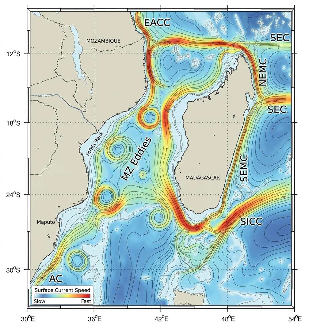
Between Mozambique and Madagascar lies a 400-km-wide channel that funnels water from the tropical Indian Ocean south toward the Agulhas Current. For decades it was drawn on maps as a single continuous flow — the “Mozambique Current.” But ships, fishers and spill responders kept seeing surface water behave in ways a steady current could not explain.
GWO set out to settle the question with measurement rather than assumption — by reading the channel through three independent observing systems and asking whether they told the same story.
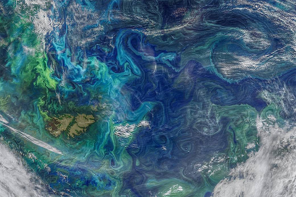
The channel is not a river. It is a conveyor of rotating cells — large eddies that detach in the north and march south, one after another.
Three observing systems, one question
Each platform constrains a different part of the water column, and all were sourced from the EU Copernicus Marine Service and processed in a single open-source Python pipeline. The test was deliberately simple: if the channel really moves as eddies, all three should independently show rotation — not a straight southward flow.
- GNSS surface drifters 2002–2024
- 121 platforms, 70,175 velocity observations at 15 m drogue depth, wind-slip corrected — the direct trace of where surface water goes.
- Argo profiling floats 2004–2024
- 53 floats on a park-and-profile cycle at ~1,000 m, reporting zonal & meridional velocity at depth and at each surfacing.
- Satellite altimetry · DUACS L4 1993–2023
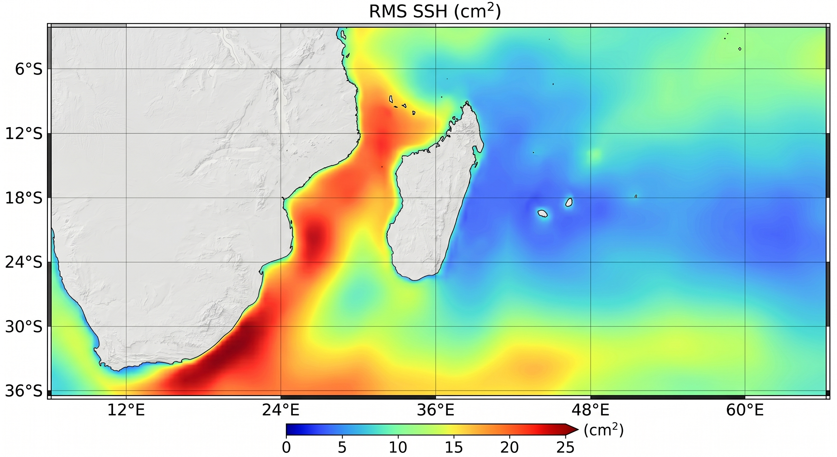
- 11,322 daily gridded sea-surface-height fields at 0.25°, with derived geostrophic velocities across the channel (30°–55°E, 25°–12°S).
- Eddy detection · py-eddy-tracker method
- Automated census from SSH — closed contours stepped at 0.002 m after a 400 km high-pass — giving each eddy a polarity, centre, radius and amplitude.
What the channel revealed
The three systems converged on the same answer — a channel filled with rotating cells, not a band of moving water. Six numbers carry the result.
There is almost no steady current
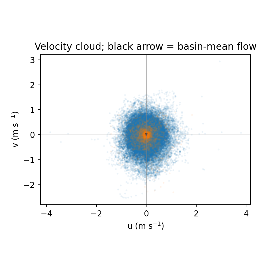
Pooled across every near-surface observation, the basin-mean flow is vanishingly weak: a mean meridional velocity of just −0.03 m/s against a mean speed of 0.48 m/s. The kinetic energy of that mean flow is only 0.4% of the total for drifters and 0.6% for Argo — meaning more than 99% of the surface energy lives in the fluctuating eddy field, not in a through-current.
Trajectories loop, they don’t run south
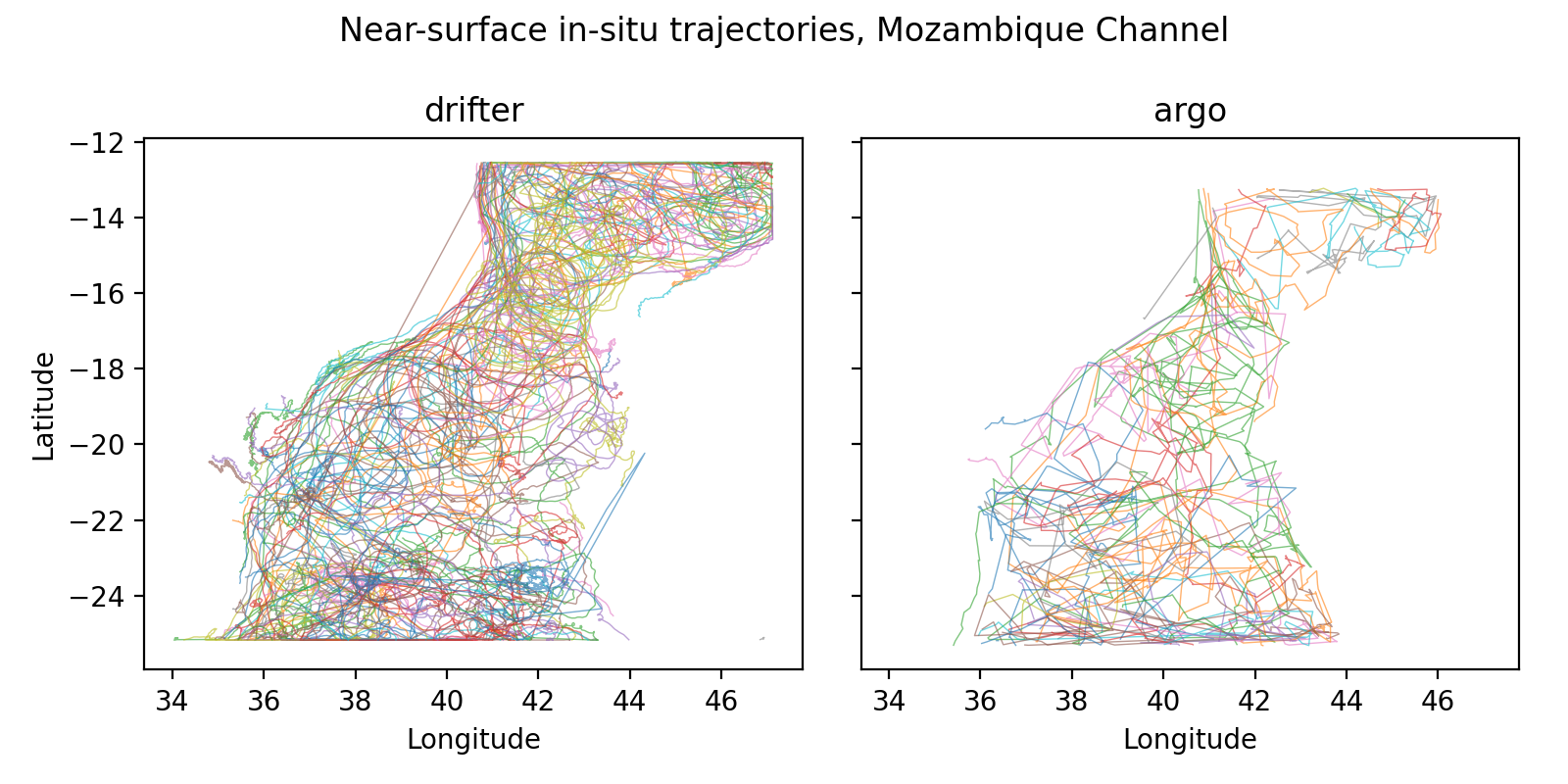
Drifter and Argo floats curl and loop through the channel rather than tracking south. A straightness index — net displacement over path length, near 1 for a straight line and near 0 for tight loops — has a median of just 0.42 for drifters and 0.22 for the longer, deeper Argo paths. That looping is the Lagrangian signature of rotating cells; a uniform current cannot produce it.
Three platforms, one circulation
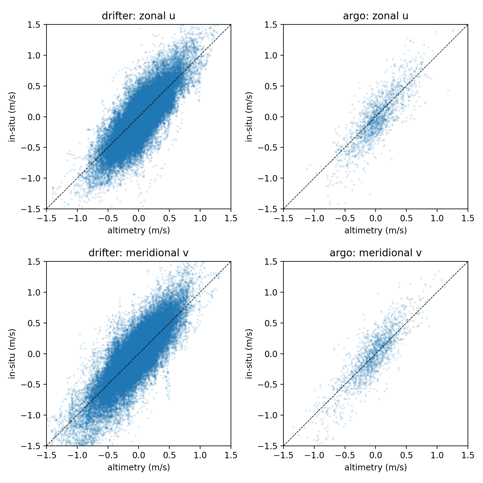
Interpolating the daily altimetry geostrophic velocity onto every in-situ observation and comparing component-by-component, the systems agree closely: Pearson correlations of 0.80–0.86 and root-mean-square differences near 0.23 m/s. The residual scatter is exactly what is expected from the wind-driven, ageostrophic motion that altimetry — being purely geostrophic — does not capture.
| Platform pair | n | r (zonal) | r (merid.) | RMSD (m/s) |
|---|---|---|---|---|
| Drifter vs. altimetry | 64,252 | 0.80 | 0.83 | 0.23 / 0.24 |
| Argo vs. altimetry | 1,719 | 0.82 | 0.86 | 0.24 / 0.24 |
Bootstrap 95% CI half-widths < 0.02 (drifter) and < 0.04 (Argo).
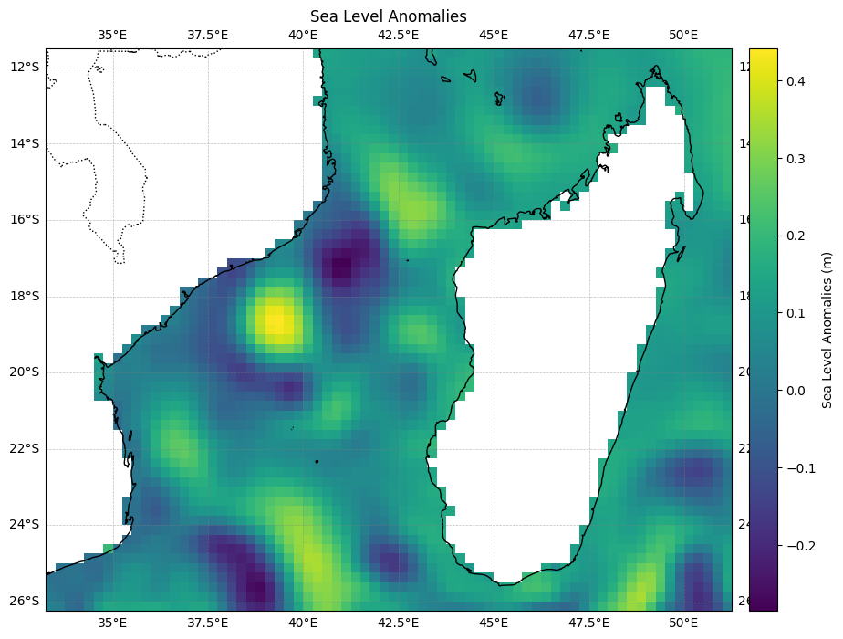
The altimetry view tells the same story directly: a single day of sea-level anomalies resolves a checkerboard of highs and lows — warm-core (anticyclonic) and cold-core (cyclonic) eddies — rather than a single banded current.
A persistent population of eddies
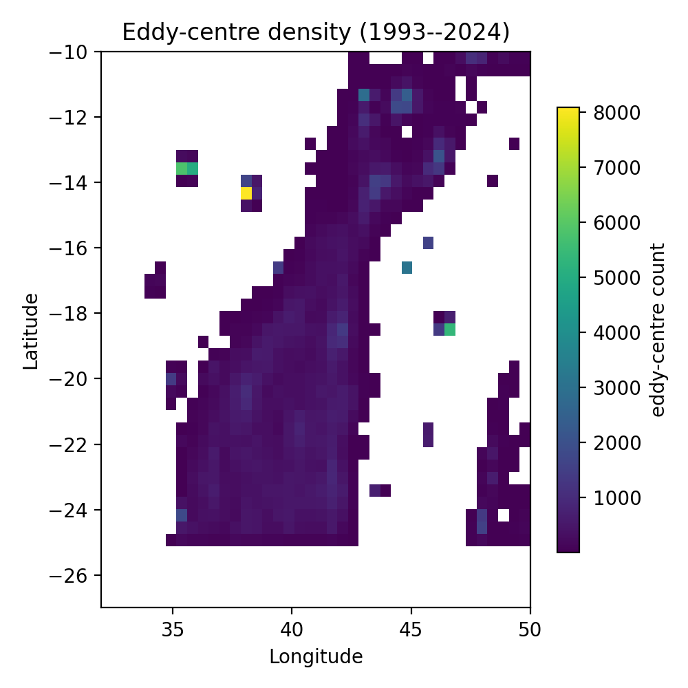
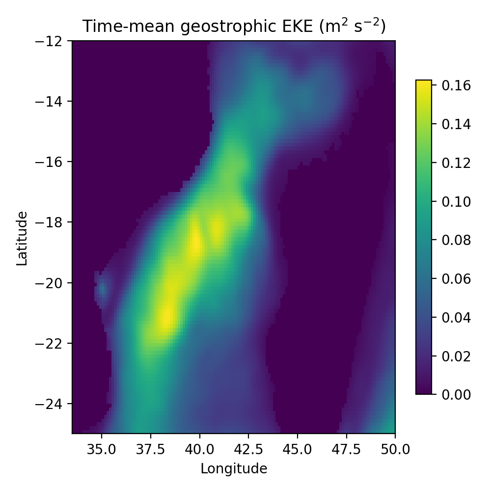
An automated census — the open-source py-eddy-tracker — run over all 11,322 daily fields finds the channel is never empty. On an average day, 10.6 anticyclonic and 8.1 cyclonic eddies are present, with anticyclones systematically larger and stronger: a mean radius of 80 km (≈160 km across), with the largest cells reaching the ~300 km scale. Eddy-centre density and time-mean eddy kinetic energy both trace one continuous high-energy corridor down the channel axis, peaking near 0.16 m²/s².
| Quantity | Anticyclonic | Cyclonic |
|---|---|---|
| Mean number present per day | 10.6 | 8.1 |
| Mean effective radius (km) | 80 ± 49 | 73 ± 49 |
| Mean amplitude (m) | 0.088 | 0.062 |
| Mean rotational speed (m/s) | 0.35 | 0.33 |
Snapshot census from py-eddy-tracker over 11,322 daily fields.
About six eddies shed south each year
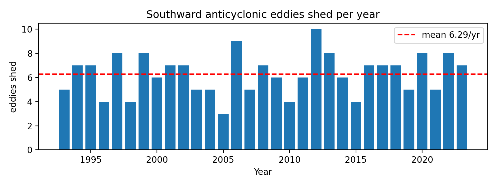
Linking the daily detections into trajectories lets us measure the shedding rate directly rather than infer it. Over 1993–2023, 6.3 ± 1.7 long-lived (≥90-day) anticyclonic eddies migrate southward through the channel each year, with a mean trajectory lifetime of 144 days. That sits squarely within the four-to-seven per year established by earlier studies — now reproduced from a single 31-year record.
From velocities to structure
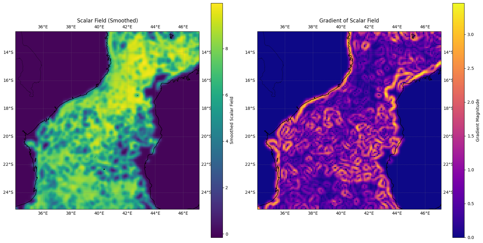
As a purely in-situ cross-check, the gridded drifter velocity field was differentiated — computing its spatial gradient to expose the boundaries between cells. The gradient map lights up the rims of individual eddies independently of the altimetry census: the very edges where rotation, upwelling and biological productivity concentrate.
The eddy field is intensifying
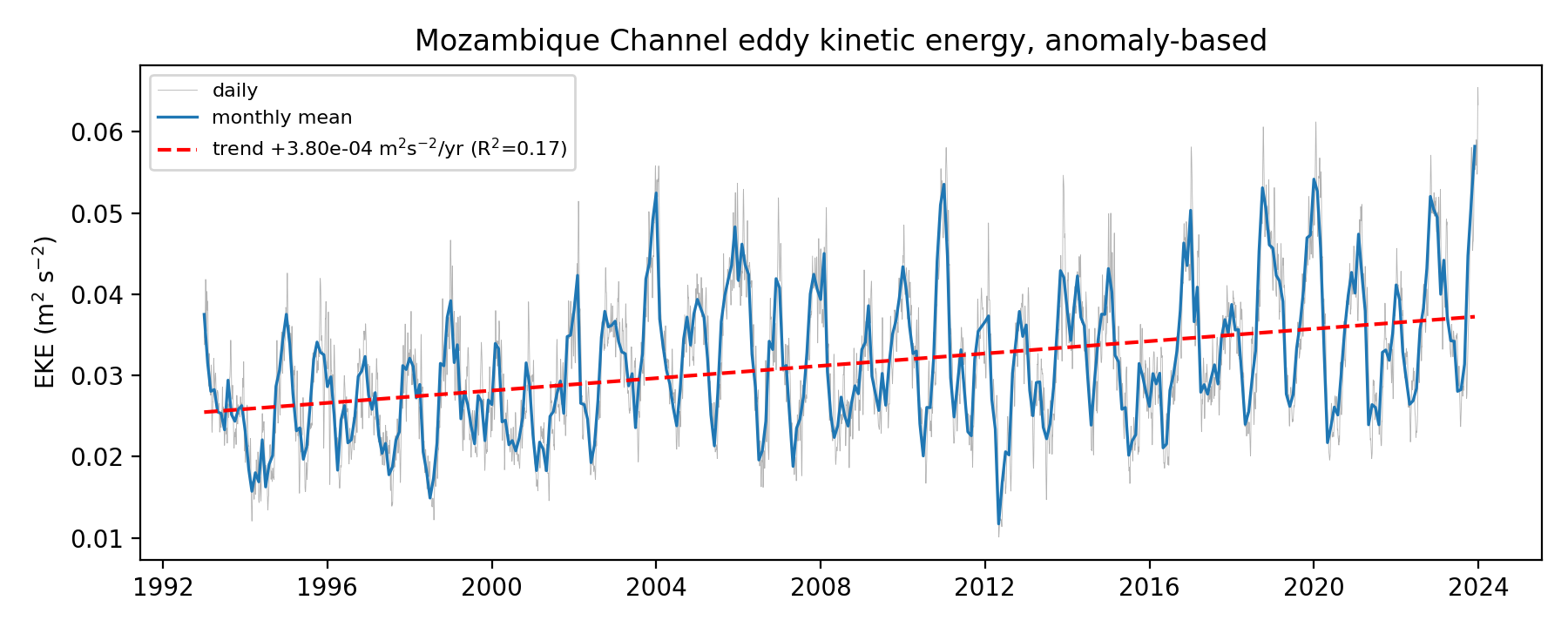
Aggregated into a monthly series, the channel’s eddy kinetic energy shows a statistically significant upward trend of about +1.2% per year over 1993–2023 (p < 10⁻¹⁵). We report this as an observed trend only — part of the rise may reflect the growing capability of the altimetry constellation across the record — but the direction is unambiguous.
Why a “spinning” channel matters
Knowing the channel is governed by discrete, trackable eddies — not an averaged current — is not an academic footnote. It changes the practical answer to almost every question stakeholders ask about these waters, because an eddy can be located, tracked and forecast in a way a smeared mean current cannot.
Smarter, sustainable fishing
Eddy rims upwell nutrients that seed plankton and aggregate fish. Eddy maps point fleets to genuine productivity hotspots — raising catch-per-effort while easing pressure on depleted grounds elsewhere.
Spill & pollution response
A rotating eddy traps and carries contaminants in a closed cell. Drift forecasts that follow the eddy field — not a straight current — sharpen containment, cleanup and liability assessment.
Search & rescue drift
A person or object adrift loops with the local eddy rather than running with a mean flow. Eddy-aware drift models tighten the search box and shorten response time.
Fuel-efficient ship routing
Surface currents inside an eddy either help or fight a vessel by a knot or more. Routing with the live eddy field cuts transit time, fuel burn and emissions.
Conservation & larval connectivity
Eddies ferry larvae, plankton and heat between reefs and coasts. Mapping these corridors informs marine-protected-area design and trans-boundary management.
Climate & cyclone outlook
Warm-core eddies feed heat and moisture to passing storms and drive Agulhas leakage into the Atlantic. Tracking them improves regional seasonal and storm forecasting.
The recommendation: track the cells, not the average
The evidence points to one operating principle — the Mozambique Channel should be monitored and modelled as a population of eddies, each with a position, age and trajectory, rather than as a single mean flow. GWO’s recommendations build a living, eddy-resolving picture of the channel.
- 01
Operational eddy tracking
Stand up a near-real-time service that detects and follows each eddy from daily altimetry, validated against drifters and Argo.
- 02
Decision layers for users
Translate the eddy field into tailored products — fishing-ground guidance, spill-drift forecasts and routing advisories.
- 03
Sustained in-situ network
Maintain drifter and Argo coverage so the satellite picture stays anchored to measured velocities at and below the surface.
- 04
Trans-boundary sharing
Make the eddy record openly available to Mozambique, Madagascar and regional fisheries and disaster agencies.
The same method — cross-validating altimetry against in-situ velocities to resolve eddies — extends to any energetic boundary-current region, turning a one-off study into a transferable monitoring capability.
Sources & data
This case study condenses independent research that fuses three open observing systems — DUACS Level-4 altimetry (EU Copernicus Marine Service), Argo profiling floats (Argo GDAC) and surface drifters (NOAA Global Drifter Program) — with eddy detection via the open-source py-eddy-tracker. For full datasets and references, please get in touch.
Need to read the ocean in front of you?
If your decisions depend on knowing where water — and everything it carries — is actually going, we turn satellite and in-situ records into operational guidance you can defend.